High-Detail Orthomosaic Maps
Detailed aerial imagery stitched into a seamless, map-ready image for site interpretation and documentation.
 Shumang Tech Solutions
DRONE SURVEY • MAPPING • 3D VISUALIZATION
High-detail aerial mapping for land, property, infrastructure and development projects — turning drone imagery into measurable maps, mapped boundaries, site plans and interactive 3D visualizations.
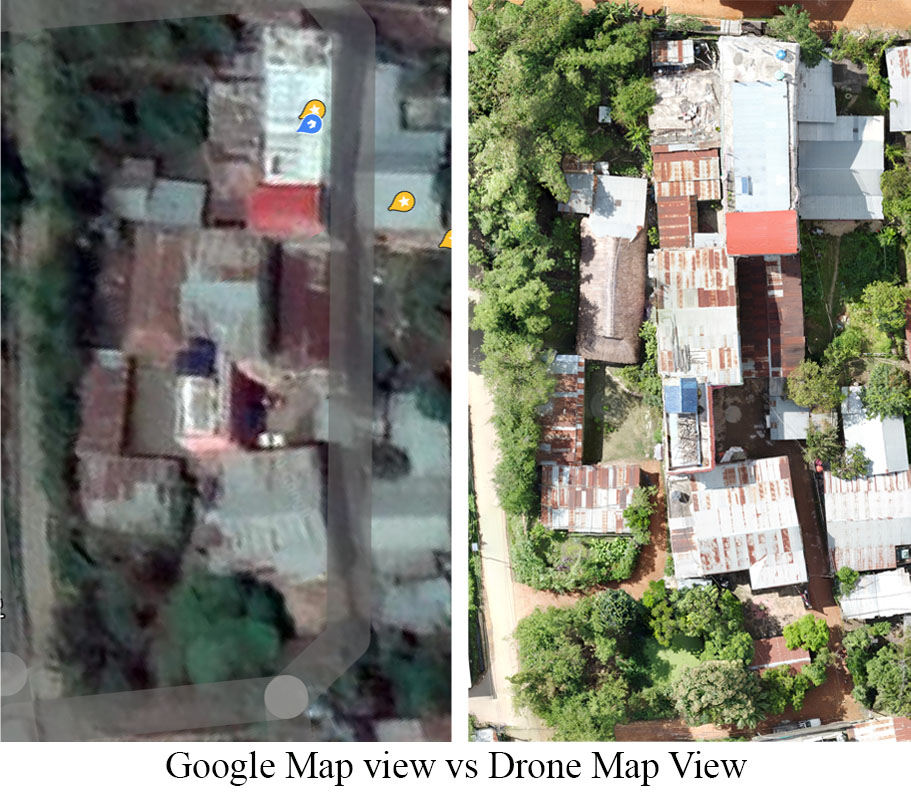
SEE THE DIFFERENCE
Conventional map imagery provides geographic context. High-resolution drone imagery can reveal much finer site-level detail for inspection, mapping and measurement.
WHAT WE DELIVER
We transform drone imagery into useful spatial deliverables for property documentation, planning, inspection, site analysis and presentation.
Detailed aerial imagery stitched into a seamless, map-ready image for site interpretation and documentation.
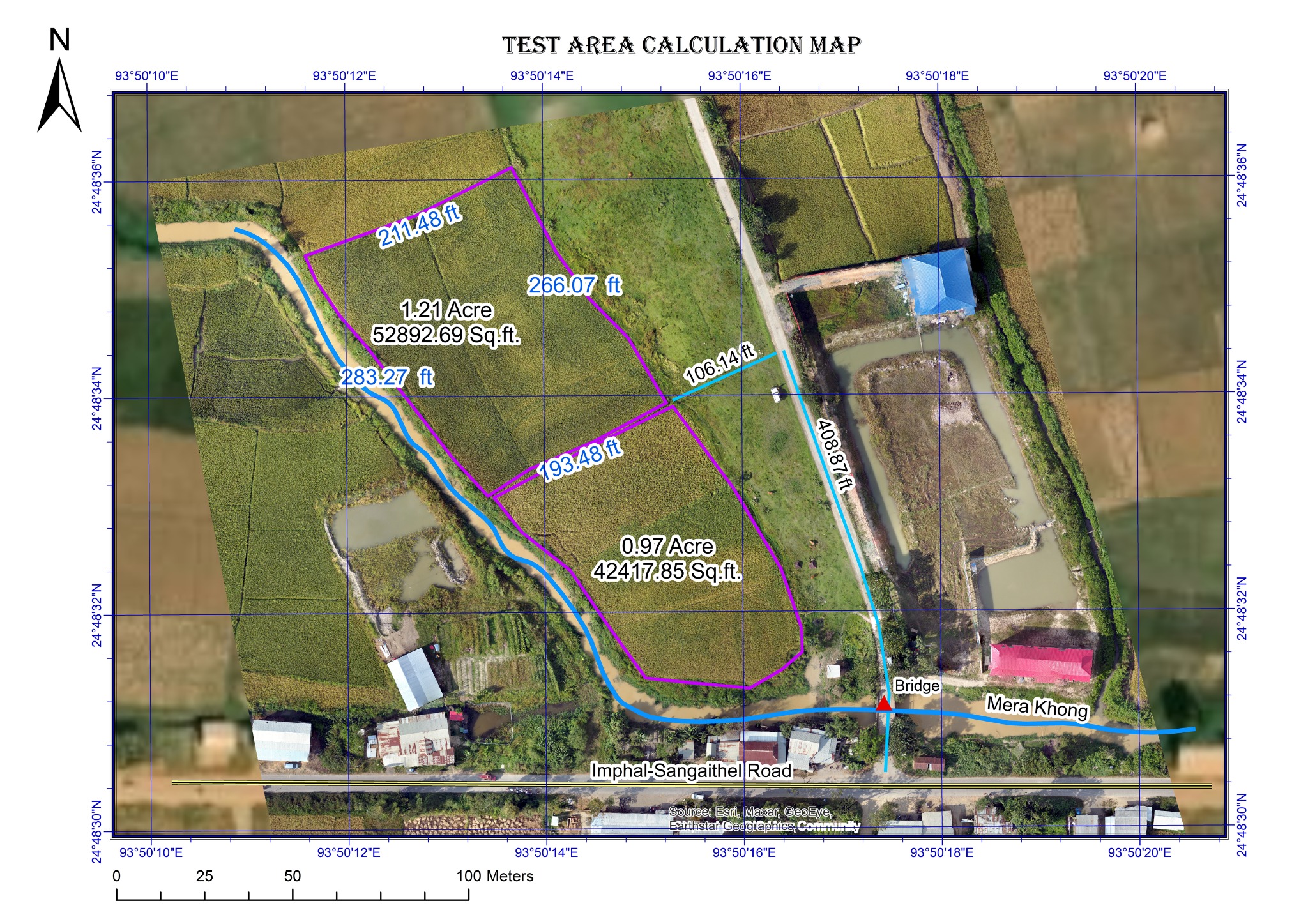
Measure mapped distances and areas and present results in square feet, acres, hectares or other required units.
Delineate property parcels, institutional boundaries, roads, waterways and other important site features.
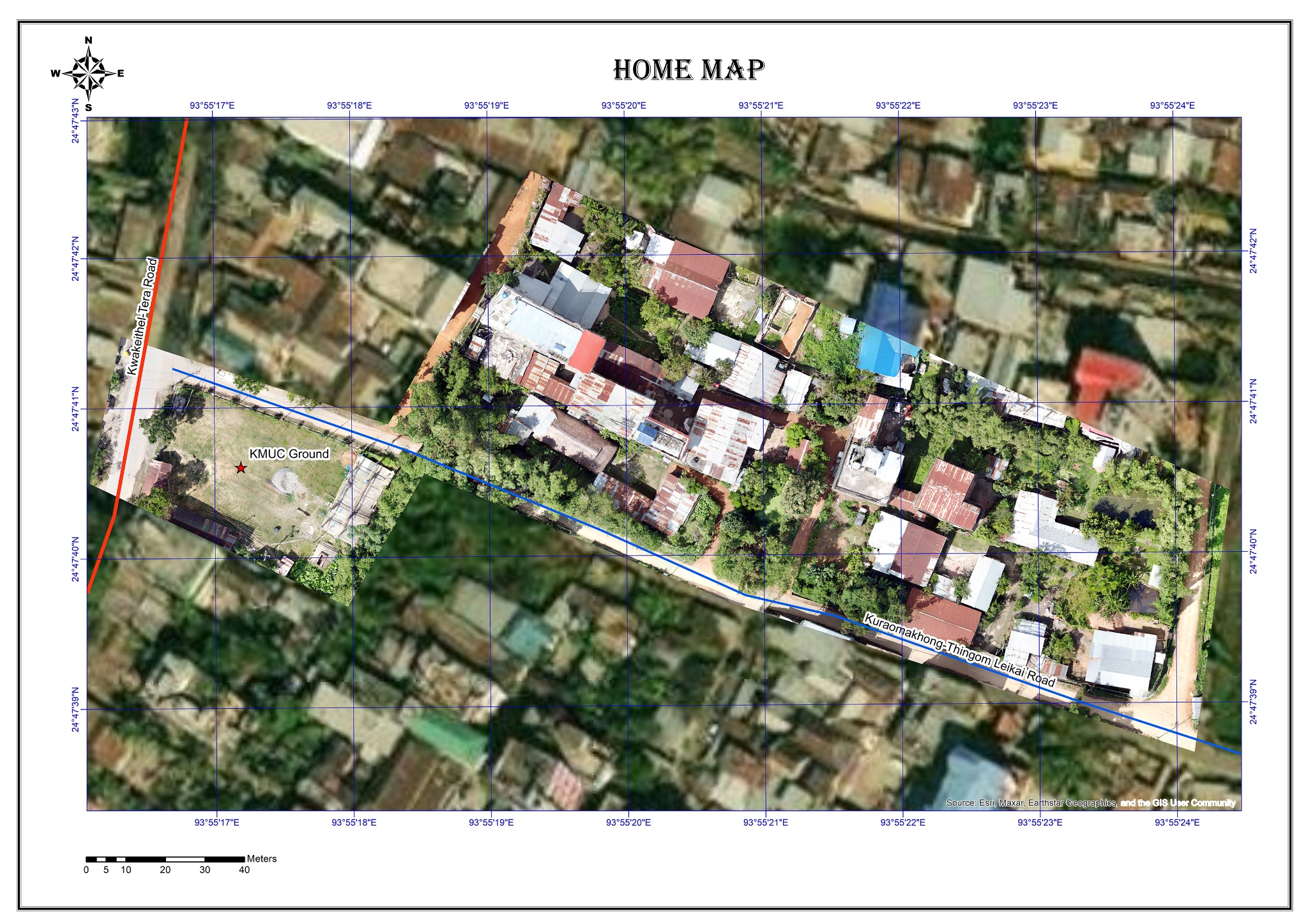
Combine current aerial imagery with existing GIS, cadastral, road or other reference information.
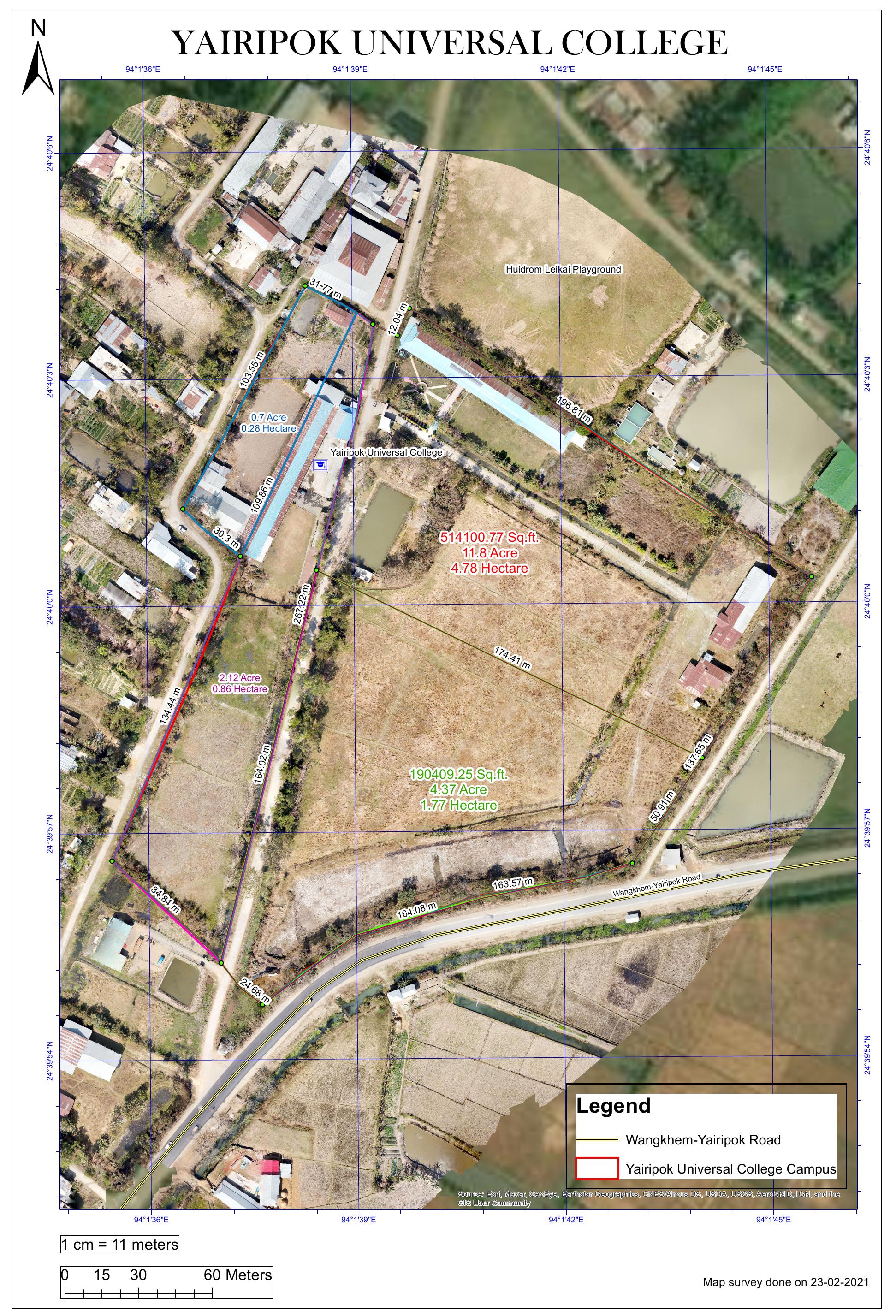
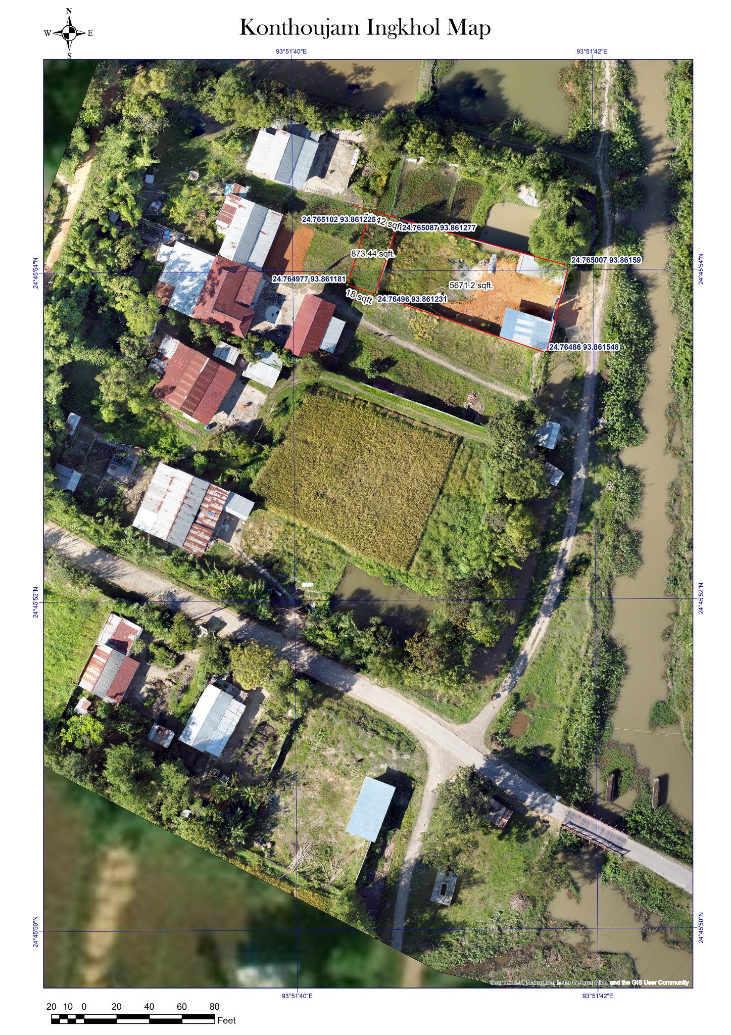
Presentation-ready maps with coordinate grids, north arrows, scale bars, labels, dimensions and annotations.
Turn photogrammetry data into interactive 3D models that can be explored directly in a web browser.
MEASUREMENT & LOCATION
Aerial mapping can be presented with dimensions, calculated areas, coordinate grids, boundaries and scale so that the imagery becomes a practical measurement and documentation tool.
Measurement precision depends on the survey workflow, imagery quality, ground control, positioning data and processing method used for the particular project.
SELECTED MAPPING WORK
Examples showing how aerial imagery can be combined with boundaries, measurements, coordinates, roads and other map information.
FEATURED PROJECT • OFFICE BUILDING
The same workflow can go beyond mapping. Drone imagery and photogrammetry can be processed into a detailed three-dimensional reconstruction for inspection, visualization and presentation.
PROJECT VIDEO
Watch the aerial presentation of the Office Building project before exploring the reconstructed model interactively.
INTERACTIVE EXPERIENCE
Rotate, pan and zoom around the photogrammetry model to inspect the building and surrounding area from different perspectives.
The model is loaded only when requested so visitors who only want to watch the video do not need to download the 3D data.
Optimized web model • approximately 35 MBDRONE • MAP • MEASURE • VISUALIZE
Talk to Shumang Tech Solutions about detailed drone mapping, land measurement, site documentation, GIS visualization or interactive 3D project deliverables.
Request a Project Discussion